Yet download failed here - not so strong pptp connection cuts off with sources as github, while to set proposed l2tp is quite story. Don't know, maybe upgrade to next Fedora version will help - manually compiled latest NetworkManager dropped previous installation to unworkable state anyway.
BTW, I noticed at wiki something as that user would need to download 70Gb prior see anything - at first thought, if it's true then it's wrong solution for sure.
Board index ‹ FlightGear ‹ Development ‹ Scenery
Next-generation scenery generating?
Re: Next-generation scenery generating?
![]() by vitos » Tue Oct 25, 2016 3:48 pm
by vitos » Tue Oct 25, 2016 3:48 pm
Waste of time: too unprofitable for work, too exhausting for hobby.
-

vitos - Posts: 615
- Joined: Sun Jan 25, 2009 9:10 pm
- Location: Moscow, Russia
- Callsign: vitos
- IRC name: vitos
- Version: 3.4
- OS: Debian
Re: Next-generation scenery generating?
![]() by psadro_gm » Tue Oct 25, 2016 5:03 pm
by psadro_gm » Tue Oct 25, 2016 5:03 pm
70Gb is the total size of all DEMs covering the whole world. Of which only the 3rd low res you need the whole world to see anything. This is about 7 MB The 1x1 tiles at high resolution is the huge part. This is why I am focusing on Hawaii - it has good mountains, and is an island. The dropbox tarball is 45 MB, and covers Hawaii in all five levels.
The next delivery will be 3 levels. Unsure how big it will be - less levels, but tiles in each level are larger. I hope to have the update this weekend.
The next delivery will be 3 levels. Unsure how big it will be - less levels, but tiles in each level are larger. I hope to have the update this weekend.
8.50 airport parser, textured roads and streams...
- psadro_gm
- Posts: 751
- Joined: Thu Aug 25, 2011 3:23 am
- Location: Atlanta, GA USA
- IRC name: psadro_*
- Version: git
- OS: Fedora 21
Re: Next-generation scenery generating?
![]() by vitos » Tue Oct 25, 2016 11:21 pm
by vitos » Tue Oct 25, 2016 11:21 pm
Everything seems to be set, but I get just water. Log is:
Previous engine works, runned it at same fps from stop to stop with whole view.
Did You follow Your own instruction for test? That got to be made at least once. Seems to be that You forgot to add "git checkout topics/new-scenery" or something as that.
Though with such addition simgear is compiled, while flightgear produces an
error. Gdal package includes
it's file, not a dir. What's next?
- Code: Select all
set from command-line argument: fg_root = Path "/home/vitos/Src/flightgear-fgdata"
Reading global preferences
Finished Reading global preferences
Reading user settings from Path "/home/vitos/.fgfs/autosave_2016_4.xml"
init package root at:Path "/home/vitos/.fgfs/Aircraft"
aircraft = ufo
Loading aircraft -set file from:Path "/home/vitos/Src/flightgear-fgdata/Aircraft/ufo/ufo-set.xml"
Found language resource for: en_US
Reading localized strings for 'en' from Path "/home/vitos/Src/flightgear-fgdata/Translations/en/sys.xml"
Reading localized strings for 'en' from Path "/home/vitos/Src/flightgear-fgdata/Translations/en/atc.xml"
   option:fg-root = /home/vitos/Src/flightgear-fgdata
   option:fg-scenery = /home/vitos/Src/DEM
   option:log-level = info
Initializing Tile Manager subsystem.
Initializing the tile cache.
  max cache size = 100
  current cache size = 0
  done with init()
sched_tile: new tile entry for:-158:0, 21:0
FGTileMgr: at lon = -158deg, lat = 21deg, elev = 1219.2m, scheduling needed for:-158:0, 21:0, visibility=32000
scheduling needed tiles for -158:0, 21:0, tile-width-m:12979.8, tile-height-m:13914.9
sched_tile: new tile entry for:-159:5, 20:5
sched_tile: new tile entry for:-159:5, 20:6
sched_tile: new tile entry for:-159:5, 20:7
sched_tile: new tile entry for:-159:5, 21:0
sched_tile: new tile entry for:-159:5, 21:1
sched_tile: new tile entry for:-159:5, 21:2
sched_tile: new tile entry for:-159:5, 21:3
sched_tile: new tile entry for:-159:6, 20:5
sched_tile: new tile entry for:-159:6, 20:6
sched_tile: new tile entry for:-159:6, 20:7
sched_tile: new tile entry for:-159:6, 21:0
sched_tile: new tile entry for:-159:6, 21:1
sched_tile: new tile entry for:-159:6, 21:2
sched_tile: new tile entry for:-159:6, 21:3
sched_tile: new tile entry for:-159:7, 20:5
sched_tile: new tile entry for:-159:7, 20:6
sched_tile: new tile entry for:-159:7, 20:7
sched_tile: new tile entry for:-159:7, 21:0
sched_tile: new tile entry for:-159:7, 21:1
sched_tile: new tile entry for:-159:7, 21:2
sched_tile: new tile entry for:-159:7, 21:3
sched_tile: new tile entry for:-158:0, 20:5
sched_tile: new tile entry for:-158:0, 20:6
sched_tile: new tile entry for:-158:0, 20:7
sched_tile: new tile entry for:-158:0, 21:1
sched_tile: new tile entry for:-158:0, 21:2
sched_tile: new tile entry for:-158:0, 21:3
sched_tile: new tile entry for:-158:1, 20:5
sched_tile: new tile entry for:-158:1, 20:6
sched_tile: new tile entry for:-158:1, 20:7
sched_tile: new tile entry for:-158:1, 21:0
sched_tile: new tile entry for:-158:1, 21:1
sched_tile: new tile entry for:-158:1, 21:2
sched_tile: new tile entry for:-158:1, 21:3
sched_tile: new tile entry for:-158:2, 20:5
sched_tile: new tile entry for:-158:2, 20:6
sched_tile: new tile entry for:-158:2, 20:7
sched_tile: new tile entry for:-158:2, 21:0
sched_tile: new tile entry for:-158:2, 21:1
sched_tile: new tile entry for:-158:2, 21:2
sched_tile: new tile entry for:-158:2, 21:3
sched_tile: new tile entry for:-158:3, 20:5
sched_tile: new tile entry for:-158:3, 20:6
sched_tile: new tile entry for:-158:3, 20:7
sched_tile: new tile entry for:-158:3, 21:0
sched_tile: new tile entry for:-158:3, 21:1
sched_tile: new tile entry for:-158:3, 21:2
sched_tile: new tile entry for:-158:3, 21:3
Loading tile 351149.stg
  Generating ocean tile: w160n20/w159n20/351149
Loading tile 367552.stg
  Generating ocean tile: w160n20/w158n21/367552
Loading tile 351175.stg
  Generating ocean tile: w160n20/w159n21/351175
Loading tile 367544.stg
  Generating ocean tile: w160n20/w158n20/367544
Loading tile 367553.stg
  Generating ocean tile: w160n20/w158n21/367553
Loading tile 367560.stg
  Generating ocean tile: w160n20/w158n21/367560
Loading tile 351167.stg
  Generating ocean tile: w160n20/w159n20/351167
Loading tile 351183.stg
  Generating ocean tile: w160n20/w159n21/351183
Loading tile 367545.stg
  Generating ocean tile: w160n20/w158n20/367545
Loading tile 367561.stg
  Generating ocean tile: w160n20/w158n21/367561
Loading tile 351174.stg
  Generating ocean tile: w160n20/w159n21/351174
Loading tile 367536.stg
  Generating ocean tile: w160n20/w158n20/367536
Loading tile 367554.stg
  Generating ocean tile: w160n20/w158n21/367554
Loading tile 367568.stg
  Generating ocean tile: w160n20/w158n21/367568
Loading tile 351159.stg
  Generating ocean tile: w160n20/w159n20/351159
Loading tile 351166.stg
  Generating ocean tile: w160n20/w159n20/351166
Loading tile 351182.stg
  Generating ocean tile: w160n20/w159n21/351182
Loading tile 351191.stg
  Generating ocean tile: w160n20/w159n21/351191
Loading tile 367537.stg
  Generating ocean tile: w160n20/w158n20/367537
Loading tile 367546.stg
  Generating ocean tile: w160n20/w158n20/367546
Loading tile 367562.stg
  Generating ocean tile: w160n20/w158n21/367562
Loading tile 367569.stg
  Generating ocean tile: w160n20/w158n21/367569
Scenery loaded, will init FDM
Start common FDM init
...initializing position...
Checking for lon = -158deg, lat = 21deg, alt = 4000ft
...initializing ground elevation to 0.00515203ft...
...initializing sea-level radius...
 lat = 21 alt = 4000
...initializing Euler angles...
...initializing velocities...
End common FDM init
Loading tile 351158.stg
  Generating ocean tile: w160n20/w159n20/351158
Loading tile 351190.stg
  Generating ocean tile: w160n20/w159n21/351190
Loading tile 367538.stg
  Generating ocean tile: w160n20/w158n20/367538
Loading tile 367570.stg
  Generating ocean tile: w160n20/w158n21/367570
Loading tile 351173.stg
  Generating ocean tile: w160n20/w159n21/351173
Loading tile 367528.stg
  Generating ocean tile: w160n20/w158n20/367528
Loading tile 367555.stg
  Generating ocean tile: w160n20/w158n21/367555
Loading tile 367576.stg
  Generating ocean tile: w160n20/w158n21/367576
Loading tile 351151.stg
  Generating ocean tile: w160n20/w159n20/351151
Loading tile 351165.stg
  Generating ocean tile: w160n20/w159n20/351165
Loading tile 351181.stg
  Generating ocean tile: w160n20/w159n21/351181
Loading tile 351199.stg
  Generating ocean tile: w160n20/w159n21/351199
Loading tile 367529.stg
  Generating ocean tile: w160n20/w158n20/367529
Loading tile 367547.stg
  Generating ocean tile: w160n20/w158n20/367547
Loading tile 367563.stg
  Generating ocean tile: w160n20/w158n21/367563
Loading tile 367577.stg
  Generating ocean tile: w160n20/w158n21/367577
Loading tile 351150.stg
  Generating ocean tile: w160n20/w159n20/351150
Loading tile 351157.stg
  Generating ocean tile: w160n20/w159n20/351157
Loading tile 351189.stg
  Generating ocean tile: w160n20/w159n21/351189
Loading tile 351198.stg
  Generating ocean tile: w160n20/w159n21/351198
Loading tile 367530.stg
  Generating ocean tile: w160n20/w158n20/367530
Loading tile 367539.stg
  Generating ocean tile: w160n20/w158n20/367539
Loading tile 367571.stg
  Generating ocean tile: w160n20/w158n21/367571
Loading tile 367578.stg
  Generating ocean tile: w160n20/w158n21/367578
Loading tile 351197.stg
  Generating ocean tile: w160n20/w159n21/351197
Loading tile 367531.stg
  Generating ocean tile: w160n20/w158n20/367531
Loading tile 367579.stg
  Generating ocean tile: w160n20/w158n21/367579
FGTileMgr: at lon = -157.967deg, lat = 21.1251deg, elev = 1219.2m, scheduling needed for:-158:0, 21:1, visibility=16093.4
scheduling needed tiles for -158:0, 21:1, tile-width-m:12968.8, tile-height-m:13914.9
FGTileMgr: at lon = -157.945deg, lat = 21.25deg, elev = 1219.2m, scheduling needed for:-158:0, 21:2, visibility=16093.4
scheduling needed tiles for -158:0, 21:2, tile-width-m:12957.8, tile-height-m:13914.9
sched_tile: new tile entry for:-159:6, 21:4
sched_tile: new tile entry for:-159:7, 21:4
sched_tile: new tile entry for:-158:0, 21:4
sched_tile: new tile entry for:-158:1, 21:4
sched_tile: new tile entry for:-158:2, 21:4
Loading tile 367584.stg
  Generating ocean tile: w160n20/w158n21/367584
Loading tile 351207.stg
  Generating ocean tile: w160n20/w159n21/351207
Loading tile 367585.stg
  Generating ocean tile: w160n20/w158n21/367585
Loading tile 351206.stg
  Generating ocean tile: w160n20/w159n21/351206
Loading tile 367586.stg
  Generating ocean tile: w160n20/w158n21/367586
Got ground pick at lon = -157.933deg, lat = 21.3519deg, elev = -0.283939m
Got ground pick at lon = -157.931deg, lat = 21.4053deg, elev = -0.166019m
Got ground pick at lon = -157.937deg, lat = 21.3374deg, elev = -0.177493m
Previous engine works, runned it at same fps from stop to stop with whole view.
Did You follow Your own instruction for test? That got to be made at least once. Seems to be that You forgot to add "git checkout topics/new-scenery" or something as that.
Though with such addition simgear is compiled, while flightgear produces an
- Code: Select all
CMake Error at utils/CMakeLists.txt:39 (add_subdirectory):
  add_subdirectory given source "gdalwarp" which is not an existing
  directory.
error. Gdal package includes
- Code: Select all
/usr/bin/gdalwarp
it's file, not a dir. What's next?
Waste of time: too unprofitable for work, too exhausting for hobby.
-
vitos - Posts: 615
- Joined: Sun Jan 25, 2009 9:10 pm
- Location: Moscow, Russia
- Callsign: vitos
- IRC name: vitos
- Version: 3.4
- OS: Debian
Re: Next-generation scenery generating?
![]() by psadro_gm » Wed Oct 26, 2016 12:30 pm
by psadro_gm » Wed Oct 26, 2016 12:30 pm
Hi Vitos,
Thanks for trying this out.
As far as the gdalwarp directory in the flightgear utils dir, that does look like a mistake. I didn't add the gdalwarp dir to the commit as it was mostly just the source from gdal. I was compiling my own version of the gdalwarp utility (with my own added debug ) to help debug the warping done by the demconvert utility. This should not have been committed to the repo.
I will remove the reference from utils/CMakeLists.txt.
As far as only seeing ocean - from the log, it looks like the terrain engine is still using the tile-cache, not the new engine. Can you confirm you have this in your cmd line:
--prop:/sim/scenery/engine=pagedLOD.
Maybe post the full cmd line, and I will try it as well. I can confirm the shell script on the wiki is the exact script I run when testing.
Pete
8.50 airport parser, textured roads and streams...
- psadro_gm
- Posts: 751
- Joined: Thu Aug 25, 2011 3:23 am
- Location: Atlanta, GA USA
- IRC name: psadro_*
- Version: git
- OS: Fedora 21
Re: Next-generation scenery generating?
![]() by vitos » Wed Oct 26, 2016 12:41 pm
by vitos » Wed Oct 26, 2016 12:41 pm
Well, seems to be I compiled not Your branch, but just common "next" branch at first. So Your engine was not even compiled, started too of course. Then I switched to branch, and got an compilation error.
With removing of gdalwarp ifdef compilation started, let's see what it will bring.
Ok, still water, but something about Your engine is at logs:
Starting code is more or less same as at example:
With removing of gdalwarp ifdef compilation started, let's see what it will bring.
Ok, still water, but something about Your engine is at logs:
- Code: Select all
set from command-line argument: fg_root = Path "/home/vitos/Src/flightgear-fgdata"
Reading global preferences
Finished Reading global preferences
Reading user settings from Path "/home/vitos/.fgfs/autosave_2016_4.xml"
init package root at:Path "/home/vitos/.fgfs/Aircraft"
aircraft = ufo
Loading aircraft -set file from:Path "/home/vitos/Src/flightgear-fgdata/Aircraft/ufo/ufo-set.xml"
Found language resource for: en_US
Reading localized strings for 'en' from Path "/home/vitos/Src/flightgear-fgdata/Translations/en/sys.xml"
Reading localized strings for 'en' from Path "/home/vitos/Src/flightgear-fgdata/Translations/en/atc.xml"
   option:fg-root = /home/vitos/Src/flightgear-fgdata
   option:fg-scenery = /home/vitos/Src/DEM
   option:log-level = info
Selected scenery is pagedLOD
FGSptTerrain::init
new DEM
Terrain init - dem path Path "/home/vitos/Src/DEM/DEM" has NO LOD Levels
Terrain init - dem path Path "DEM" has NO LOD Levels
Terrain init - dem path Path "/home/vitos/.fgfs/TerraSync/DEM" has NO LOD Levels
Terrain init - dem path Path "DEM" has NO LOD Levels
create mesh lvl 0,0 as 3 x 3
create mesh lvl 0,0 as 3 x 3
create mesh lvl 0,0 as 3 x 3
create mesh lvl 0,0 as 3 x 3
create mesh lvl 0,0 as 3 x 3
create mesh lvl 0,0 as 3 x 3
Scenery loaded, will init FDM
Start common FDM init
...initializing position...
Checking for lon = -158deg, lat = 21deg, alt = 4000ft
...initializing ground elevation to 328.084ft...
...initializing sea-level radius...
 lat = 21 alt = 4000
...initializing Euler angles...
...initializing velocities...
End common FDM init
create mesh lvl 1,2 as 5 x 9
create mesh lvl 1,2 as 5 x 9
create mesh lvl 1,2 as 5 x 9
create mesh lvl 1,2 as 5 x 9
create mesh lvl 1,2 as 5 x 9
create mesh lvl 1,2 as 5 x 9
create mesh lvl 1,2 as 5 x 9
create mesh lvl 1,2 as 5 x 9
create mesh lvl 1,2 as 5 x 9
create mesh lvl 1,2 as 5 x 9
create mesh lvl 1,2 as 5 x 9
create mesh lvl 1,2 as 5 x 9
create mesh lvl 1,2 as 5 x 9
create mesh lvl 1,2 as 5 x 9
create mesh lvl 1,2 as 5 x 9
create mesh lvl 1,2 as 5 x 9
create mesh lvl 1,2 as 5 x 9
create mesh lvl 1,2 as 5 x 9
create mesh lvl 1,2 as 5 x 9
create mesh lvl 1,2 as 5 x 9
create mesh lvl 1,2 as 5 x 9
create mesh lvl 1,2 as 5 x 9
create mesh lvl 1,2 as 5 x 9
create mesh lvl 1,2 as 5 x 9
create mesh lvl 1,2 as 5 x 9
create mesh lvl 1,2 as 5 x 9
create mesh lvl 1,2 as 5 x 9
create mesh lvl 1,2 as 5 x 9
create mesh lvl 1,2 as 5 x 9
create mesh lvl 1,2 as 5 x 9
create mesh lvl 1,2 as 5 x 9
create mesh lvl 1,2 as 5 x 9
create mesh lvl 1,2 as 5 x 9
create mesh lvl 1,2 as 5 x 9
create mesh lvl 1,2 as 5 x 9
create mesh lvl 1,2 as 5 x 9
create mesh lvl 1,2 as 5 x 9
create mesh lvl 1,2 as 5 x 9
create mesh lvl 1,2 as 5 x 9
create mesh lvl 1,2 as 5 x 9
create mesh lvl 1,2 as 5 x 9
create mesh lvl 1,2 as 5 x 9
create mesh lvl 1,2 as 5 x 9
create mesh lvl 1,2 as 5 x 9
create mesh lvl 1,2 as 5 x 9
create mesh lvl 1,2 as 5 x 9
create mesh lvl 1,2 as 5 x 9
create mesh lvl 1,2 as 5 x 9
create mesh lvl 1,2 as 5 x 9
create mesh lvl 1,2 as 5 x 9
FGStgTerrain::get_elevation_m: alt 100 no material
FGStgTerrain::get_elevation_m: alt 100 no material
FGStgTerrain::get_elevation_m: alt 100 no material
FGStgTerrain::get_elevation_m: alt 100 no material
create mesh lvl 2,2 as 9 x 9
create mesh lvl 2,2 as 9 x 9
create mesh lvl 2,2 as 9 x 9
create mesh lvl 2,2 as 9 x 9
create mesh lvl 2,2 as 9 x 9
create mesh lvl 2,2 as 9 x 9
create mesh lvl 2,2 as 9 x 9
create mesh lvl 2,2 as 9 x 9
create mesh lvl 2,2 as 9 x 9
create mesh lvl 2,2 as 9 x 9
create mesh lvl 2,2 as 9 x 9
create mesh lvl 2,2 as 9 x 9
create mesh lvl 3,3 as 17 x 17
create mesh lvl 3,3 as 17 x 17
create mesh lvl 3,3 as 17 x 17
create mesh lvl 3,3 as 17 x 17
create mesh lvl 3,3 as 17 x 17
create mesh lvl 3,3 as 17 x 17
create mesh lvl 3,3 as 17 x 17
create mesh lvl 3,3 as 17 x 17
create mesh lvl 3,3 as 17 x 17
create mesh lvl 3,3 as 17 x 17
create mesh lvl 3,3 as 17 x 17
create mesh lvl 3,3 as 17 x 17
create mesh lvl 3,3 as 17 x 17
create mesh lvl 3,3 as 17 x 17
create mesh lvl 3,3 as 17 x 17
create mesh lvl 3,3 as 17 x 17
create mesh lvl 3,3 as 17 x 17
create mesh lvl 3,3 as 17 x 17
create mesh lvl 4,4 as 33 x 33
create mesh lvl 4,4 as 33 x 33
create mesh lvl 4,4 as 33 x 33
create mesh lvl 4,4 as 33 x 33
create mesh lvl 4,4 as 33 x 33
create mesh lvl 4,4 as 33 x 33
create mesh lvl 4,4 as 33 x 33
create mesh lvl 4,4 as 33 x 33
create mesh lvl 5,5 as 49 x 49
create mesh lvl 5,5 as 49 x 49
create mesh lvl 5,5 as 49 x 49
create mesh lvl 5,5 as 49 x 49
create mesh lvl 5,5 as 49 x 49
create mesh lvl 5,5 as 49 x 49
create mesh lvl 5,5 as 49 x 49
create mesh lvl 5,5 as 49 x 49
create mesh lvl 6,6 as 65 x 65
create mesh lvl 6,6 as 65 x 65
create mesh lvl 6,6 as 65 x 65
create mesh lvl 6,6 as 65 x 65
create mesh lvl 6,6 as 65 x 65
create mesh lvl 6,6 as 65 x 65
create mesh lvl 6,6 as 65 x 65
create mesh lvl 6,6 as 65 x 65
create mesh lvl 6,6 as 65 x 65
create mesh lvl 6,6 as 65 x 65
create mesh lvl 6,6 as 65 x 65
create mesh lvl 6,6 as 65 x 65
create mesh lvl 7,7 as 93 x 93
create mesh lvl 7,7 as 93 x 93
create mesh lvl 7,7 as 93 x 93
create mesh lvl 7,7 as 93 x 93
create mesh lvl 7,7 as 93 x 93
create mesh lvl 7,7 as 93 x 93
create mesh lvl 7,7 as 93 x 93
create mesh lvl 7,7 as 93 x 93
create mesh lvl 8,8 as 151 x 151
create mesh lvl 8,8 as 151 x 151
create mesh lvl 8,8 as 151 x 151
create mesh lvl 8,8 as 151 x 151
FGStgTerrain::get_elevation_m: alt 100 no material
FGStgTerrain::get_elevation_m: alt 100 no material
FGStgTerrain::get_elevation_m: alt 100 no material
FGStgTerrain::get_elevation_m: alt 100 no material
FGStgTerrain::get_elevation_m: alt 100 no material
FGStgTerrain::get_elevation_m: alt 100 no material
FGStgTerrain::get_elevation_m: alt 100 no material
FGStgTerrain::get_elevation_m: alt 100 no material
create mesh lvl 8,8 as 151 x 151
create mesh lvl 8,8 as 151 x 151
create mesh lvl 8,8 as 151 x 151
create mesh lvl 8,8 as 151 x 151
FGStgTerrain::get_elevation_m: alt 100 no material
FGStgTerrain::get_elevation_m: alt 100 no material
FGStgTerrain::get_elevation_m: alt 100 no material
FGStgTerrain::get_elevation_m: alt 100 no material
FGStgTerrain::get_elevation_m: alt 100 no material
FGStgTerrain::get_elevation_m: alt 100 no material
FGStgTerrain::get_elevation_m: alt 100 no material
FGStgTerrain::get_elevation_m: alt 100 no material
create mesh lvl 7,7 as 93 x 93
create mesh lvl 7,7 as 93 x 93
create mesh lvl 7,7 as 93 x 93
create mesh lvl 7,7 as 93 x 93
create mesh lvl 6,6 as 65 x 65
create mesh lvl 6,6 as 65 x 65
create mesh lvl 6,6 as 65 x 65
create mesh lvl 6,6 as 65 x 65
create mesh lvl 8,8 as 151 x 151
create mesh lvl 8,8 as 151 x 151
create mesh lvl 8,8 as 151 x 151
create mesh lvl 8,8 as 151 x 151
FGStgTerrain::get_elevation_m: alt 100 no material
FGStgTerrain::get_elevation_m: alt 100 no material
FGStgTerrain::get_elevation_m: alt 100 no material
FGStgTerrain::get_elevation_m: alt 100 no material
create mesh lvl 7,7 as 93 x 93
create mesh lvl 7,7 as 93 x 93
create mesh lvl 7,7 as 93 x 93
create mesh lvl 7,7 as 93 x 93
create mesh lvl 3,3 as 17 x 17
create mesh lvl 3,3 as 17 x 17
create mesh lvl 3,3 as 17 x 17
create mesh lvl 3,3 as 17 x 17
create mesh lvl 3,3 as 17 x 17
create mesh lvl 3,3 as 17 x 17
create mesh lvl 3,3 as 17 x 17
create mesh lvl 3,3 as 17 x 17
FGStgTerrain::get_elevation_m: alt 100 no material
FGStgTerrain::get_elevation_m: alt 100 no material
FGStgTerrain::get_elevation_m: alt 100 no material
FGStgTerrain::get_elevation_m: alt 100 no material
create mesh lvl 3,3 as 17 x 17
create mesh lvl 8,8 as 151 x 151
create mesh lvl 8,8 as 151 x 151
create mesh lvl 8,8 as 151 x 151
create mesh lvl 8,8 as 151 x 151
FGStgTerrain::get_elevation_m: alt 100 no material
FGStgTerrain::get_elevation_m: alt 100 no material
FGStgTerrain::get_elevation_m: alt 100 no material
FGStgTerrain::get_elevation_m: alt 100 no material
Starting code is more or less same as at example:
- Code: Select all
LOG_CLASS=--log-class=terrain,flight
LOG_LEVEL=--log-level=info

FGROOT=--fg-root=${HOME}/Src/flightgear-fgdata
SCENERY=--fg-scenery=${HOME}/Src/DEM

# HAWAII
START_POS="--lon=-158.0 --lat=21.0 --altitude=4000"

TERRAIN_ENGINE="pagedLOD"
LOD_RES="1"
LOD_RANGEMULT="2"
LOD_LEVELS="1 2 3 4 5 6 7 8 9"
LOD_LEVEL_RES="3 5 9 17 33 49 65 93 151"
ZFAR="9600000"

/opt/FlightGear/flightgear/bin/fgfs ${FGROOT} ${SCENERY} ${LOG_LEVEL} ${LOG_CLASS} ${START_POS} --timeofday=noon --aircraft=ufo --prop:double:/sim/rendering/camera-group/zfar=${ZFAR} --prop:/sim/scenery/engine="${TERRAIN_ENGINE}" --prop:/sim/scenery/lod-levels="${LOD_LEVELS}" --prop:/sim/scenery/lod-res="${LOD_RES}" --prop:/sim/scenery/lod-level-res="${LOD_LEVEL_RES}" --prop:/sim/scenery/lod-range-mult="${LOD_RANGEMULT}"
Waste of time: too unprofitable for work, too exhausting for hobby.
-
vitos - Posts: 615
- Joined: Sun Jan 25, 2009 9:10 pm
- Location: Moscow, Russia
- Callsign: vitos
- IRC name: vitos
- Version: 3.4
- OS: Debian
Re: Next-generation scenery generating?
![]() by psadro_gm » Wed Oct 26, 2016 2:59 pm
by psadro_gm » Wed Oct 26, 2016 2:59 pm
ok - looks good - did you download the hawwiidem tarball into /home/vitos/Src/ ? if so - just use that as the extra scenery path - it will append /DEM to the path.
Terrain init - dem path Path "/home/vitos/Src/DEM/DEM" has NO LOD Levels
Directly under /home/vitos/Src/DEM/ should be:
level_01
level_02, etc...
if you use --fg-scenery=${HOME}/Src/ in your command line.
and - yes - I am starting a bit over the water here. you may need to climb a bit higher to find Hawaii next up - I want to flatten PHNL (at runtime), and allow a fixed wing aircraft to start on the ground.
Pete
Terrain init - dem path Path "/home/vitos/Src/DEM/DEM" has NO LOD Levels
Directly under /home/vitos/Src/DEM/ should be:
level_01
level_02, etc...
if you use --fg-scenery=${HOME}/Src/ in your command line.
and - yes - I am starting a bit over the water here. you may need to climb a bit higher to find Hawaii
Pete
8.50 airport parser, textured roads and streams...
- psadro_gm
- Posts: 751
- Joined: Thu Aug 25, 2011 3:23 am
- Location: Atlanta, GA USA
- IRC name: psadro_*
- Version: git
- OS: Fedora 21
Re: Next-generation scenery generating?
![]() by vitos » Wed Oct 26, 2016 3:06 pm
by vitos » Wed Oct 26, 2016 3:06 pm
Well, You made it a bit nonstandard way - compare with way FGDATA is set. There You set path with directory name, while at You case - without.
Ok, now I do not have a water too. Just pale blue screen with things as
at log. DEM was get by link and extracted, directories are presented.
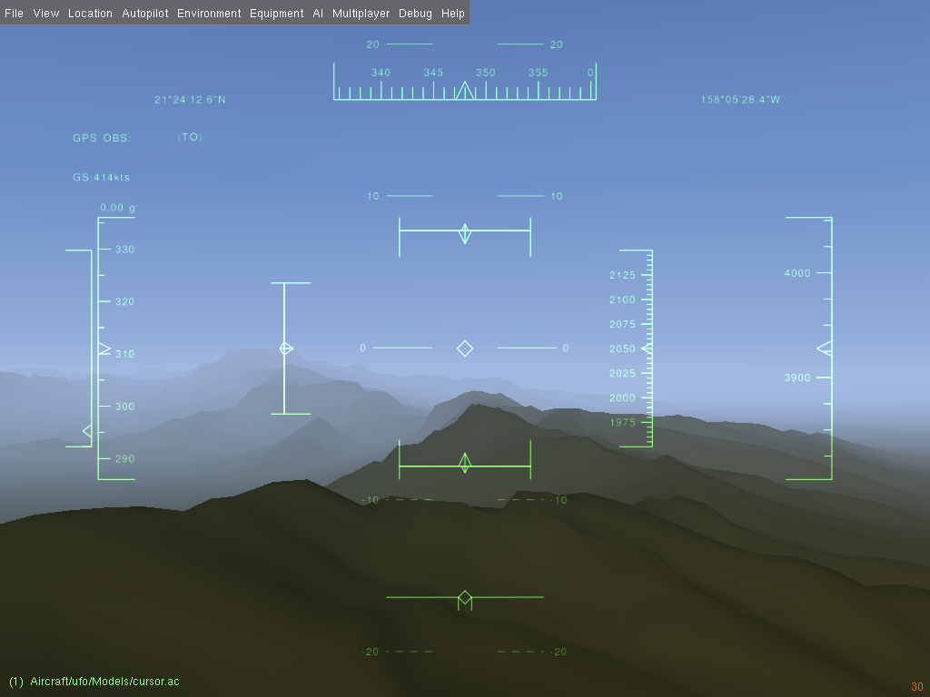
Wait... Ok, something is there.
Ok, now I do not have a water too. Just pale blue screen with things as
- Code: Select all
ERROR 4: `/home/vitos/Src/DEM/level_01/N22W158.hgt' does not exist in the file system,
and is not recognised as a supported dataset name.

SGDemTile::SGDemTile (read ) - could not open file /home/vitos/Src/DEM/level_01/N22W158.hgt
create mesh lvl 5,5 as 49 x 49
ERROR 4: `/home/vitos/Src/DEM/level_01/N22W157.hgt' does not exist in the file system,
and is not recognised as a supported dataset name.

SGDemTile::SGDemTile (read ) - could not open file /home/vitos/Src/DEM/level_01/N22W157.hgt
create mesh lvl 5,5 as 49 x 49
ERROR 4: `/home/vitos/Src/DEM/level_01/N23W158.hgt' does not exist in the file system,
and is not recognised as a supported dataset name.

SGDemTile::SGDemTile (read ) - could not open file /home/vitos/Src/DEM/level_01/N23W158.hgt
create mesh lvl 5,5 as 49 x 49
ERROR 4: `/home/vitos/Src/DEM/level_01/N23W157.hgt' does not exist in the file system,
and is not recognised as a supported dataset name.

SGDemTile::SGDemTile (read ) - could not open file /home/vitos/Src/DEM/level_01/N23W157.hgt
FGStgTerrain::get_elevation_m: alt 100 no material
FGStgTerrain::get_elevation_m: alt 100 no material
FGStgTerrain::get_elevation_m: alt 100 no material
FGStgTerrain::get_elevation_m: alt 100 no material
create mesh lvl 4,4 as 33 x 33
ERROR 4: `/home/vitos/Src/DEM/level_02/N22W156.hgt' does not exist in the file system,
and is not recognised as a supported dataset name.

SGDemTile::SGDemTile (read ) - could not open file /home/vitos/Src/DEM/level_02/N22W156.hgt
create mesh lvl 4,4 as 33 x 33
ERROR 4: `/home/vitos/Src/DEM/level_02/N22W154.hgt' does not exist in the file system,
and is not recognised as a supported dataset name.

SGDemTile::SGDemTile (read ) - could not open file /home/vitos/Src/DEM/level_02/N22W154.hgt
create mesh lvl 4,4 as 33 x 33
ERROR 4: `/home/vitos/Src/DEM/level_02/N24W156.hgt' does not exist in the file system,
and is not recognised as a supported dataset name.

SGDemTile::SGDemTile (read ) - could not open file /home/vitos/Src/DEM/level_02/N24W156.hgt
create mesh lvl 4,4 as 33 x 33
ERROR 4: `/home/vitos/Src/DEM/level_02/N24W154.hgt' does not exist in the file system,
and is not recognised as a supported dataset name.

SGDemTile::SGDemTile (read ) - could not open file /home/vitos/Src/DEM/level_02/N24W154.hgt
FGStgTerrain::get_elevation_m: alt 100 no material
FGStgTerrain::get_elevation_m: alt 100 no material
FGStgTerrain::get_elevation_m: alt 100 no material
FGStgTerrain::get_elevation_m: alt 100 no material
FGStgTerrain::get_elevation_m: alt 100 no material
FGStgTerrain::get_elevation_m: alt 100 no material
at log. DEM was get by link and extracted, directories are presented.
Wait... Ok, something is there.
Last edited by vitos on Wed Oct 26, 2016 3:16 pm, edited 2 times in total.
Waste of time: too unprofitable for work, too exhausting for hobby.
-
vitos - Posts: 615
- Joined: Sun Jan 25, 2009 9:10 pm
- Location: Moscow, Russia
- Callsign: vitos
- IRC name: vitos
- Version: 3.4
- OS: Debian
Re: Next-generation scenery generating?
![]() by psadro_gm » Wed Oct 26, 2016 3:13 pm
by psadro_gm » Wed Oct 26, 2016 3:13 pm
Nice!
The delay ( and pulling in successively detailed terrain around the aircraft ) is because I still don't have a way to know when scenery loading is 'done' - so The dialog box disappears before scenery starts loading.
This makes any aircraft that needs ground interaction at boot kind of impossible. i need to determine when the highest LOD around the aircraft has been loaded by OpenSceneGraph before letting the dialog close, and FDMs to init.
The lots of could not open file errors are expected - I've only included a small sample set around Hawaii. Ideally, it will be downloading the tiles from terrasync.
The scenery path is the same as current scenery path setups. We already append Terrain for the tiles, and Objects for scenery objects - I am adding DEM for height data, and will be appending Landclass for the landclass rasters.
The quality of the meshes ( that are not pushed yet ) are better than what they appear with that dem, but I want to get the normals and skirts done before next push.
8.50 airport parser, textured roads and streams...
- psadro_gm
- Posts: 751
- Joined: Thu Aug 25, 2011 3:23 am
- Location: Atlanta, GA USA
- IRC name: psadro_*
- Version: git
- OS: Fedora 21
Re: Next-generation scenery generating?
![]() by vitos » Wed Oct 26, 2016 3:50 pm
by vitos » Wed Oct 26, 2016 3:50 pm
Got Your idea. Ok, yet all looks as needed for initial state.


Good. And why it could not be done before, can I ask noble public?
Good. And why it could not be done before, can I ask noble public?
Waste of time: too unprofitable for work, too exhausting for hobby.
-
vitos - Posts: 615
- Joined: Sun Jan 25, 2009 9:10 pm
- Location: Moscow, Russia
- Callsign: vitos
- IRC name: vitos
- Version: 3.4
- OS: Debian
Re: Next-generation scenery generating?
![]() by psadro_gm » Wed Oct 26, 2016 4:12 pm
by psadro_gm » Wed Oct 26, 2016 4:12 pm
Well, it still has a long way to go. The visuals at close range are pretty bad
The infrastructure I'm basing this off of ( SPT tiles ) has been in simgear for > 2 years. The idea was to simplify our normal .BTG tiles for middle LOD ranges, then use the regular grid / blue marble for really distant range.
Unfortunately - simplifying the corrine landclass tiles was very problematic. When the idea to use raster images instead of vector based landclassing arose, using a regular grid became an option. I am still unsure how coastlines , and vector roads/rivers will work. but, as the wiki is tiltled - it's experimental
8.50 airport parser, textured roads and streams...
- psadro_gm
- Posts: 751
- Joined: Thu Aug 25, 2011 3:23 am
- Location: Atlanta, GA USA
- IRC name: psadro_*
- Version: git
- OS: Fedora 21
Re: Next-generation scenery generating?
![]() by vitos » Wed Oct 26, 2016 4:14 pm
by vitos » Wed Oct 26, 2016 4:14 pm
At now it looks better than EarthView, dont take much fps - so at least for orbital rendering that will go.
Actually it's better than major engine with its zigzag rivers too - it just dont have anything as that.
Actually it's better than major engine with its zigzag rivers too - it just dont have anything as that.
Waste of time: too unprofitable for work, too exhausting for hobby.
-
vitos - Posts: 615
- Joined: Sun Jan 25, 2009 9:10 pm
- Location: Moscow, Russia
- Callsign: vitos
- IRC name: vitos
- Version: 3.4
- OS: Debian
Re: Next-generation scenery generating?
![]() by psadro_gm » Sun Nov 27, 2016 4:41 pm
by psadro_gm » Sun Nov 27, 2016 4:41 pm
I have a progress update. I will be pushing the new mesh soon. It still has an issue at 12x12 degrees and higher where tiles meet - looks like some artificial valleys when seen from space. I am pretty sure it's a roundoff error when generating the grid. I haven't tracked it down, yet. I wanted to make some more progress so I started the landclass rasterization script.
It is a fairly simple script that uses GDAL tools to categorize, chop, merge, then rasterize the images for each tile. It took 80 minutes on my computer to rasterize Hawaii. ( if this holds, it would take 75 days for the whole world. )
The categorization step only needs to be done once, and if we ever accept custom shapefiles from scenery designers, we would expect this step to be done before submitting - it basically encodes the landclass into each shapefile geometry, so when we merge - each shape retains its landclass encoding.
Here is what Hawaii looks like in QGIS post rasterization ( with band1 = red, band2 = green, band3 = blue ) = actual encoding will be more like band1 = landclass code, band2 = smoothing, etc...

And here's zoomed in near Honolulu airport:

I will start trying to map each tile to its own image in flightgear next week.
It is a fairly simple script that uses GDAL tools to categorize, chop, merge, then rasterize the images for each tile. It took 80 minutes on my computer to rasterize Hawaii. ( if this holds, it would take 75 days for the whole world. )
The categorization step only needs to be done once, and if we ever accept custom shapefiles from scenery designers, we would expect this step to be done before submitting - it basically encodes the landclass into each shapefile geometry, so when we merge - each shape retains its landclass encoding.
Here is what Hawaii looks like in QGIS post rasterization ( with band1 = red, band2 = green, band3 = blue ) = actual encoding will be more like band1 = landclass code, band2 = smoothing, etc...
And here's zoomed in near Honolulu airport:
I will start trying to map each tile to its own image in flightgear next week.
8.50 airport parser, textured roads and streams...
- psadro_gm
- Posts: 751
- Joined: Thu Aug 25, 2011 3:23 am
- Location: Atlanta, GA USA
- IRC name: psadro_*
- Version: git
- OS: Fedora 21
Re: Next-generation scenery generating?
![]() by psadro_gm » Sun Nov 27, 2016 4:52 pm
by psadro_gm » Sun Nov 27, 2016 4:52 pm
and here's an image of the new mesh resulutions - highest res == SRTM3

8.50 airport parser, textured roads and streams...
- psadro_gm
- Posts: 751
- Joined: Thu Aug 25, 2011 3:23 am
- Location: Atlanta, GA USA
- IRC name: psadro_*
- Version: git
- OS: Fedora 21
Re: Next-generation scenery generating?
![]() by Thorsten » Sun Nov 27, 2016 4:57 pm
by Thorsten » Sun Nov 27, 2016 4:57 pm
Sweet... Looking forward to seeing this textured
- Thorsten
- Posts: 12490
- Joined: Mon Nov 02, 2009 9:33 am
Re: Next-generation scenery generating?
![]() by vitos » Sun Nov 27, 2016 4:58 pm
by vitos » Sun Nov 27, 2016 4:58 pm
psadro_gm wrote in Sun Nov 27, 2016 4:52 pm:and here's an image of the new mesh resulutions - highest res == SRTM3
It would be nice to have some "like" button here at forum.
Waste of time: too unprofitable for work, too exhausting for hobby.
-
vitos - Posts: 615
- Joined: Sun Jan 25, 2009 9:10 pm
- Location: Moscow, Russia
- Callsign: vitos
- IRC name: vitos
- Version: 3.4
- OS: Debian
Who is online
Users browsing this forum: david.megginson and 3 guests