I have a keen interest in the China-Burma-India "Himalaya Hump" operations in WWII, and have been compiling maps and data on the subject, but have been frustrated by the lack of airports in the flightgear scenery (Terrasync). I thought I'd task myself with creating some very simple airfields along the route (some of the actual locations are now unknown, while others may or may not be on the site of modern airports).
Trouble is, I run windows, and have followed the winding toolchain trail to a brick wall. TerraGear for windows is apparently abandoned, broken, or obsolete.
Is it possible for windows users to develop scenery at all? I'm not sure where to go next. I've been reading a thread "getting good windows builds from the Jenkins server" elsewhere, and it's too thick with detail and discussion to use as any instruction. The wiki has broken links. Pretty frustrating.
I'm really surprised at how many airports show up on the map dialog, which aren't really there in the scenery of China. I realize that the Chinese are currently building airports at a rate that would take a competent scenery developer probably couldn't keep up with, but it's pretty amazing how little development there actually is in Southern China.
I don't know where to go from here. I've installed World Editor, OK. TerraGear won't work. I don't know about installing VM. I have Ubuntu on an external drive, but because of my video card, I can't fly flightgear in linux.
What's the best option for me? Install some VM software and learn to use that so I can do fake linux? Or, run Ubuntu only for the sake of TerraGear? Or maybe create some airport data and hand it off to someone who can use TerraGear?
Board index ‹ FlightGear ‹ Development ‹ Scenery
Is it possible to create a new airport in Windows?
56 posts
• Page 1 of 4 • 1, 2, 3, 4
Is it possible to create a new airport in Windows?
![]() by Kabuki » Sat Jul 05, 2014 11:53 pm
by Kabuki » Sat Jul 05, 2014 11:53 pm
This is a family-friendly saloon. No talk stink.
- Kabuki
- Posts: 584
- Joined: Sat Oct 24, 2009 12:21 am
- Location: Usually on the ground, always in the sky, except when underwater.
- Callsign: Kabuki
- Version: 3.0.0
- OS: Windows 7
Re: Is it possible to create a new airport in Windows?
![]() by Hooray » Sun Jul 06, 2014 12:01 am
by Hooray » Sun Jul 06, 2014 12:01 am
Kabuki wrote in Sat Jul 05, 2014 11:53 pm:I don't know where to go from here. I've installed World Editor, OK. TerraGear won't work. I don't know about installing VM. I have Ubuntu on an external drive, but because of my video card, I can't fly flightgear in linux.
What's the best option for me? Install some VM software and learn to use that so I can do fake linux? Or, run Ubuntu only for the sake of TerraGear? Or maybe create some airport data and hand it off to someone who can use TerraGear?
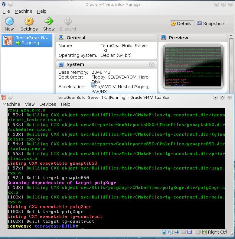
That's what I was going to suggest: Installing TerraGear in a VM isn't exactly difficult these days, thanks to the pre-built packages provided by some contributors. We used that method for the whole TerraGear build server thing, which didn't involve any building from source: http://wiki.flightgear.org/TerraGear_sc ... ild_server
You could probably also download F-JJTH's web-frontend and teach it to control TerraGear that way.
Otherwise, exchanging files with the VM may prove to be a pit tricky for people not familiar with windows/linux networking (SAMBA!).
For the sake of simplicity, and if that's even an option, dual-booting into a debian/ubuntu-based distro may not be such a bad option, you could even use GRASS/QGIS there.
Overall, I find your whole idea pretty interesting, and I do know that other folks are interested in "historical WWII scenery" as well.
I think I could help you and walk you through the whole Linux VM setup process, I'd only ask to please document the whole experience via the wiki.
If you find that too intimidating, of if you are not familiar with windows networking (samba) or SSH/SFTP, I'd suggest to get in touch with wlbragg, who was working towards "fixing" TG to build on Windows again - depending on his progress, he might even be able to simply provide working binaries to you. Otherwise, extending on F-JJTH's TerraGear Web GUI is probably going to be more work than simply using Gijs' TerraGear GUi under Linux.
EDIT: It seemed that there are some compilation issues that prevent the TG packages from being updated by saiarcot895, as per: http://wiki.flightgear.org/Talk:TerraGe ... cot895_.29
Maybe psadro_gm could have a look ?
Please don't send support requests by PM, instead post your questions on the forum so that all users can contribute and benefit
Thanks & all the best,
Hooray
Help write next month's newsletter !
pui2canvas | MapStructure | Canvas Development | Programming resources
Thanks & all the best,
Hooray
Help write next month's newsletter !
pui2canvas | MapStructure | Canvas Development | Programming resources
- Hooray
- Posts: 12707
- Joined: Tue Mar 25, 2008 9:40 am
- Pronouns: THOU
Re: Is it possible to create a new airport in Windows?
![]() by surpii » Sun Jul 06, 2014 12:19 am
by surpii » Sun Jul 06, 2014 12:19 am
Some of the landmarks and buildings are there, Shanghai has the most complete skyline (in my opinion), but the airports are hopelessly out of date. Nearly all the major airports have added a runway or two since they were last updated, and many airports are missing. I'd love to create the Checkerboard Hill once I learn how and if I have time.
- surpii
- Posts: 245
- Joined: Wed Apr 23, 2014 5:41 am
Re: Is it possible to create a new airport in Windows?
![]() by Kabuki » Sun Jul 06, 2014 1:19 am
by Kabuki » Sun Jul 06, 2014 1:19 am
surpii wrote in Sun Jul 06, 2014 12:19 am:Some of the landmarks and buildings are there, Shanghai has the most complete skyline (in my opinion), but the airports are hopelessly out of date. Nearly all the major airports have added a runway or two since they were last updated, and many airports are missing. I'd love to create the Checkerboard Hill once I learn how and if I have time.
The area I'm interested in is the area that was known as "The Hump", which was a network of air routes used to fly supplies into China from India during WWII, http://en.wikipedia.org/wiki/The_Hump There are quite a few other references on the web, including interviews on YouTube with former pilots. There were several types of aircraft flown, but the "classic" was the C-47, which has been beautifully modeled for flightgear
This is a family-friendly saloon. No talk stink.
- Kabuki
- Posts: 584
- Joined: Sat Oct 24, 2009 12:21 am
- Location: Usually on the ground, always in the sky, except when underwater.
- Callsign: Kabuki
- Version: 3.0.0
- OS: Windows 7
Re: Is it possible to create a new airport in Windows?
![]() by Kabuki » Sun Jul 06, 2014 2:06 am
by Kabuki » Sun Jul 06, 2014 2:06 am
@Hooray, thanks for the feedback and offering to help. The more I read, the more complicated and unclear this scenery building process becomes, so I think I'm just going to keep learning to use WED, and hope for the day when TG for windows is working again. I'm also pretty busy just consolidating all the information I'm finding, into some Google Earth overlays. Then, maybe I can contribute something nice to the "places to fly" part of the Wiki.
This is a family-friendly saloon. No talk stink.
- Kabuki
- Posts: 584
- Joined: Sat Oct 24, 2009 12:21 am
- Location: Usually on the ground, always in the sky, except when underwater.
- Callsign: Kabuki
- Version: 3.0.0
- OS: Windows 7
Re: Is it possible to create a new airport in Windows?
![]() by elgaton » Sun Jul 06, 2014 10:18 am
by elgaton » Sun Jul 06, 2014 10:18 am
@Kabuki,
I regularly use Windows as my scenery build environment and can confirm the latest TerraGear builds are (sort of) working again (they used to be broken for some months, but some contributors managed to fix them).
I'm detailing the manual build process step by step.
Hope this helps! (Think I'll add this to the wiki once I've got some time...)
I regularly use Windows as my scenery build environment and can confirm the latest TerraGear builds are (sort of) working again (they used to be broken for some months, but some contributors managed to fix them).
I'm detailing the manual build process step by step.
-
Download the latest TerraGear build from the FlightGear build server.(EDIT: as of now, the Windows build of TerraGear has been disabled. You can use this archived build on my Dropbox). - Right-click on the ZIP file, choose Properties, click on Unblock and then on OK (this will stop security warnings from appearing when you run
- Open the ZIP file and open the "archive", "install" and "msvc100" directories inside it. You should find a "TerraGear" directory inside, copy it to your FlightGear installation directory (usually "C:\Program Files\FlightGear"). From now on, I'll assume that the path of the TerraGear directory is C:\Program Files\FlightGear\TerraGear; if not, change it accordingly.
- Download OpenSSL1.0.1h Light, run the installer and, when prompted, choose to copy the OpenSSL DLLs to the OpenSSL binaries directory. Copy ssleay32.dll, libssl32.dll and libeay32.dll from the OpenSSL installation directory to C:\Program Files\FlightGear\TerraGear\bin.
- Create a directory to hold your scenery (I'll assume it's C:\Users\Username\Desktop\FGScenery in what follows) and create three directories named data, output and work inside it.
- Go to the FlightGear map server shape download page, in the section Download every polygon from the Landcover database within a given bounding box query input the bounding box coordinates of the area you want to build scenery for (use WED to get them), choose the "CLC2006v16" bundle, click on Download.
- In the section Download individual layers input the same bounding box coordinates, select just the "srtm_elevation" layer and download it. Repeat the operation with the "v0_landmass" layer.
- You will now have three ZIP files containing the terrain data. Open the data directory you created in step 5 and open the ZIP file containing the CLC2006v16 bundle. Inside that archive there are groups of four files each (each group corresponds to a "landclass", or terrain type). For each landclass, create a new directory in C:\Users\Username\Desktop\FGScenery\data with the same name as the landclass and put the four files in there; for example, clc06_airport.dbf, clc06_airport.prj, clc06_airport.shp and clc06_airport.shx must be put in C:\Users\Username\Desktop\FGScenery\data\clc06_airport.
- Put the four files of the "v0_landmass" layer in C:\Users\Username\Desktop\FGScenery\data\v0_landmass.
- Put the four files of the "srtm_elevation" layer in C:\Users\Username\Desktop\FGScenery\data\SRTM-3 (note that the directory name is different).
- Create a new directory in C:\Users\Username\Desktop\FGScenery\data\ named airports.
- From WED, open your airport, choose File -> Export Target -> Global Airport Database, then File -> Validate. Fix any errors.
- Choose File -> Export apt.dat... and save the airport in C:\Users\Username\Desktop\FGScenery\data\airports\apt.dat.
- Open Notepad, copy and paste the following code. Replace C:\Users\Username\Desktop\FGScenery and C:\Program Files\FlightGear\TerraGear if needed. In the tg-construct invocation, change the --min-lat, --max-lat, --min-lon and --max-lon parameters with the values you chose for the bounding box when downloading the shapefiles. Save the file as C:\Users\Username\Desktop\FGScenery\build.bat:
- Code: Select all
@echo off
cd "C:\Users\Username\Desktop\FGScenery"
for %%f in (.\data\SRTM-3\*.hgt) do "C:\Program Files\FlightGear\TerraGear\bin\hgtchop" 3 %%f .\work\SRTM-3
"C:\Program Files\FlightGear\TerraGear\bin\terrafit" --minnodes 50 --maxnodes 50000 --maxerror 20 work\SRTM-3
"C:\Program Files\FlightGear\TerraGear\bin\genapts850.exe" --input=data/airports/apt.dat --work=./work
"C:\Program Files\FlightGear\TerraGear/bin/ogr-decode" --line-width 10 --texture-lines --area-type Airport "C:\Users\Username\Desktop\FGScenery/work/Airport" "C:\Users\Username\Desktop\FGScenery/data/clc06_airport"
"C:\Program Files\FlightGear\TerraGear/bin/ogr-decode" --line-width 10 --texture-lines --area-type BarrenCover "C:\Users\Username\Desktop\FGScenery/work/BarrenCover" "C:\Users\Username\Desktop\FGScenery/data/clc06_barrencover"
"C:\Program Files\FlightGear\TerraGear/bin/ogr-decode" --line-width 10 --texture-lines --area-type ComplexCrop "C:\Users\Username\Desktop\FGScenery/work/ComplexCrop" "C:\Users\Username\Desktop\FGScenery/data/clc06_complexcrop"
"C:\Program Files\FlightGear\TerraGear/bin/ogr-decode" --line-width 10 --texture-lines --area-type Construction "C:\Users\Username\Desktop\FGScenery/work/Construction" "C:\Users\Username\Desktop\FGScenery/data/clc06_construction"
"C:\Program Files\FlightGear\TerraGear/bin/ogr-decode" --line-width 10 --texture-lines --area-type CropGrass "C:\Users\Username\Desktop\FGScenery/work/CropGrass" "C:\Users\Username\Desktop\FGScenery/data/clc06_cropgrass"
"C:\Program Files\FlightGear\TerraGear/bin/ogr-decode" --line-width 10 --texture-lines --area-type DeciduousForest "C:\Users\Username\Desktop\FGScenery/work/DeciduousForest" "C:\Users\Username\Desktop\FGScenery/data/clc06_deciduousforest"
"C:\Program Files\FlightGear\TerraGear/bin/ogr-decode" --line-width 10 --texture-lines --area-type DryCrop "C:\Users\Username\Desktop\FGScenery/work/DryCrop" "C:\Users\Username\Desktop\FGScenery/data/clc06_drycrop"
"C:\Program Files\FlightGear\TerraGear/bin/ogr-decode" --line-width 10 --texture-lines --area-type EvergreenForest "C:\Users\Username\Desktop\FGScenery/work/EvergreenForest" "C:\Users\Username\Desktop\FGScenery/data/clc06_evergreenforest"
"C:\Program Files\FlightGear\TerraGear/bin/ogr-decode" --line-width 10 --texture-lines --area-type GolfCourse "C:\Users\Username\Desktop\FGScenery/work/GolfCourse" "C:\Users\Username\Desktop\FGScenery/data/clc06_golfcourse"
"C:\Program Files\FlightGear\TerraGear/bin/ogr-decode" --line-width 10 --texture-lines --area-type Grassland "C:\Users\Username\Desktop\FGScenery/work/Grassland" "C:\Users\Username\Desktop\FGScenery/data/clc06_grassland"
"C:\Program Files\FlightGear\TerraGear/bin/ogr-decode" --line-width 10 --texture-lines --area-type Greenspace "C:\Users\Username\Desktop\FGScenery/work/Greenspace" "C:\Users\Username\Desktop\FGScenery/data/clc06_greenspace"
"C:\Program Files\FlightGear\TerraGear/bin/ogr-decode" --line-width 10 --texture-lines --area-type Heath "C:\Users\Username\Desktop\FGScenery/work/Heath" "C:\Users\Username\Desktop\FGScenery/data/clc06_heath"
"C:\Program Files\FlightGear\TerraGear/bin/ogr-decode" --line-width 10 --texture-lines --area-type Industrial "C:\Users\Username\Desktop\FGScenery/work/Industrial" "C:\Users\Username\Desktop\FGScenery/data/clc06_industrial"
"C:\Program Files\FlightGear\TerraGear/bin/ogr-decode" --line-width 10 --texture-lines --area-type Lake "C:\Users\Username\Desktop\FGScenery/work/Lake" "C:\Users\Username\Desktop\FGScenery/data/clc06_lake"
"C:\Program Files\FlightGear\TerraGear/bin/ogr-decode" --line-width 10 --texture-lines --area-type Marsh "C:\Users\Username\Desktop\FGScenery/work/Marsh" "C:\Users\Username\Desktop\FGScenery/data/clc06_marsh"
"C:\Program Files\FlightGear\TerraGear/bin/ogr-decode" --line-width 10 --texture-lines --area-type MixedCrop "C:\Users\Username\Desktop\FGScenery/work/MixedCrop" "C:\Users\Username\Desktop\FGScenery/data/clc06_mixedcrop"
"C:\Program Files\FlightGear\TerraGear/bin/ogr-decode" --line-width 10 --texture-lines --area-type MixedForest "C:\Users\Username\Desktop\FGScenery/work/MixedForest" "C:\Users\Username\Desktop\FGScenery/data/clc06_mixedforest"
"C:\Program Files\FlightGear\TerraGear/bin/ogr-decode" --line-width 10 --texture-lines --area-type NaturalCrop "C:\Users\Username\Desktop\FGScenery/work/NaturalCrop" "C:\Users\Username\Desktop\FGScenery/data/clc06_naturalcrop"
"C:\Program Files\FlightGear\TerraGear/bin/ogr-decode" --line-width 10 --texture-lines --area-type Olives "C:\Users\Username\Desktop\FGScenery/work/Olives" "C:\Users\Username\Desktop\FGScenery/data/clc06_olives"
"C:\Program Files\FlightGear\TerraGear/bin/ogr-decode" --line-width 10 --texture-lines --area-type OpenMining "C:\Users\Username\Desktop\FGScenery/work/OpenMining" "C:\Users\Username\Desktop\FGScenery/data/clc06_openmining"
"C:\Program Files\FlightGear\TerraGear/bin/ogr-decode" --line-width 10 --texture-lines --area-type Orchard "C:\Users\Username\Desktop\FGScenery/work/Orchard" "C:\Users\Username\Desktop\FGScenery/data/clc06_orchard"
"C:\Program Files\FlightGear\TerraGear/bin/ogr-decode" --line-width 10 --texture-lines --area-type Rice "C:\Users\Username\Desktop\FGScenery/work/Rice" "C:\Users\Username\Desktop\FGScenery/data/clc06_rice"
"C:\Program Files\FlightGear\TerraGear/bin/ogr-decode" --line-width 10 --texture-lines --area-type Rock "C:\Users\Username\Desktop\FGScenery/work/Rock" "C:\Users\Username\Desktop\FGScenery/data/clc06_rock"
"C:\Program Files\FlightGear\TerraGear/bin/ogr-decode" --line-width 10 --texture-lines --area-type Sand "C:\Users\Username\Desktop\FGScenery/work/Sand" "C:\Users\Username\Desktop\FGScenery/data/clc06_sand"
"C:\Program Files\FlightGear\TerraGear/bin/ogr-decode" --line-width 10 --texture-lines --area-type ScrubCover "C:\Users\Username\Desktop\FGScenery/work/ScrubCover" "C:\Users\Username\Desktop\FGScenery/data/clc06_scrub"
"C:\Program Files\FlightGear\TerraGear/bin/ogr-decode" --line-width 10 --texture-lines --area-type Town "C:\Users\Username\Desktop\FGScenery/work/Town" "C:\Users\Username\Desktop\FGScenery/data/clc06_town"
"C:\Program Files\FlightGear\TerraGear/bin/ogr-decode" --line-width 10 --texture-lines --area-type Transport "C:\Users\Username\Desktop\FGScenery/work/Transport" "C:\Users\Username\Desktop\FGScenery/data/clc06_transport"
"C:\Program Files\FlightGear\TerraGear/bin/ogr-decode" --line-width 10 --texture-lines --area-type Urban "C:\Users\Username\Desktop\FGScenery/work/Urban" "C:\Users\Username\Desktop\FGScenery/data/clc06_urban"
"C:\Program Files\FlightGear\TerraGear/bin/ogr-decode" --line-width 10 --texture-lines --area-type Vineyard "C:\Users\Username\Desktop\FGScenery/work/Vineyard" "C:\Users\Username\Desktop\FGScenery/data/clc06_vineyard"
"C:\Program Files\FlightGear\TerraGear/bin/ogr-decode" --line-width 10 --texture-lines --area-type Watercourse "C:\Users\Username\Desktop\FGScenery/work/Watercourse" "C:\Users\Username\Desktop\FGScenery/data/clc06_watercourse"
"C:\Program Files\FlightGear\TerraGear/bin/ogr-decode" --line-width 10 --texture-lines --area-type Default "C:\Users\Username\Desktop\FGScenery/work/Landmass" "C:\Users\Username\Desktop\FGScenery/data/v0_landmass"
"C:\Program Files\FlightGear\TerraGear/bin/tg-construct" --priorities="C:\Program Files\FlightGear\TerraGear/share/TerraGear/default_priorities.txt" --usgs-map="C:\Program Files\FlightGear\TerraGear/share/TerraGear/usgsmap.txt" --work-dir="C:\Users\Username\Desktop\FGScenery/work" --output-dir="C:\Users\Username\Desktop\FGScenery/output/Terrain" --ignore-landmass --min-lat=minlat --max-lat=maxlat --min-lon=minlon --max-lon=maxlon Airport AirportArea AirportObj BarrenCover ComplexCrop Construction CropGrass DeciduousForest DryCrop EvergreenForest GolfCourse Grassland Greenspace Heath Industrial Lake Landmass Marsh MixedCrop MixedForest NaturalCrop Olives OpenMining Orchard Rice Rock Sand ScrubCover SRTM-3 Town Transport Urban Vineyard Watercourse
pause
- Open Notepad again, copy and paste this code, change the paths and latitudes/longitudes as described above and save the file as C:\Users\Username\Desktop\FGScenery\build_airportonly.bat:
- Code: Select all
@echo off
cd "C:\Users\Username\Desktop\FGScenery"
rmdir /s /q "C:\Users\Username\Desktop\FGScenery\work\Airport"
rmdir /s /q "C:\Users\Username\Desktop\FGScenery\work\AirportArea"
rmdir /s /q "C:\Users\Username\Desktop\FGScenery\work\AirportObj"
"C:\Program Files\FlightGear\TerraGear\bin\genapts850.exe" --input=data/airports/apt.dat --work=./work
"C:\Program Files\FlightGear\TerraGear/bin/ogr-decode" --line-width 10 --texture-lines --area-type Airport "C:\Users\Username\Desktop\FGScenery/work/Airport" "C:\Users\Username\Desktop\FGScenery/data/clc06_airport"
"C:\Program Files\FlightGear\TerraGear/bin/tg-construct" --priorities="C:\Program Files\FlightGear\TerraGear/share/TerraGear/default_priorities.txt" --usgs-map="C:\Program Files\FlightGear\TerraGear/share/TerraGear/usgsmap.txt" --work-dir="C:\Users\Username\Desktop\FGScenery/work" --output-dir="C:\Users\Username\Desktop\FGScenery/output/Terrain" --ignore-landmass --min-lat=minlat --max-lat=maxlat --min-lon=minlon --max-lon=maxlon Airport AirportArea AirportObj BarrenCover ComplexCrop Construction CropGrass DeciduousForest DryCrop EvergreenForest GolfCourse Grassland Greenspace Heath Industrial Lake Landmass Marsh MixedCrop MixedForest NaturalCrop Olives OpenMining Orchard Rice Rock Sand ScrubCover SRTM-3 Town Transport Urban Vineyard Watercourse
pause
- Run build.bat to build the scenery. This may take several minutes (on my computer, building a 1x2 scenery area from scratch takes 30/40 minutes).
- After the first build, if you want to update the airport, just export the apt.dat file overwriting the previous one and run build_airportonly.bat.
Hope this helps! (Think I'll add this to the wiki once I've got some time...)
Last edited by elgaton on Sat Sep 20, 2014 6:57 pm, edited 1 time in total.
NIATCA 2nd admin, regular ATC at LIPX and creator of the LIPX custom scenery
- elgaton
- Posts: 1106
- Joined: Tue Mar 19, 2013 5:58 pm
- Callsign: I-ELGA/LIPX_TW
- Version: Git
- OS: Windows + Arch Linux
Re: Is it possible to create a new airport in Windows?
![]() by ludomotico » Sun Jul 06, 2014 10:35 am
by ludomotico » Sun Jul 06, 2014 10:35 am
Kabuki wrote in Sat Jul 05, 2014 11:53 pm:Or maybe create some airport data and hand it off to someone who can use TerraGear?
Hi Kabuki,
Even if your best option is having a working terragear on your system, either Windows, VM or your Live Ubuntu (you don't need running FlightGear to build scenery, so terragear will run perfectly on your external drive), I can help you in running terragear if you provide me the apt.dat. I can even consider modeling some buildings for your airports.
This is the way we are building a custom scenery for Argentina: sa7k uses WED, I run terragear and hk9001 models the buildings. Team work makes the dream work!
-

ludomotico - Posts: 1269
- Joined: Tue Apr 24, 2012 2:01 pm
- Version: nightly
- OS: Windows 10
Re: Is it possible to create a new airport in Windows?
![]() by Gijs » Sun Jul 06, 2014 11:01 am
by Gijs » Sun Jul 06, 2014 11:01 am
As far as the TerraGear issues go, I don't believe there's anything preventing you from running genapts on Windows. You don't need to do a full scenery build just to see what the airport will look like in FlightGear. Running genapt will be sufficient to check your airport layout before submitting it to http://data.x-plane.com It will then show up in the next scenery build (including surrounding terrain).
Of course it's nicer to do a full scenery build, but while you're working on the layout, just running genapt is easier/faster.
See http://wiki.flightgear.org/Howto:Test_y ... k_and_easy
The map dialog is supposed to match the scenery. If it's not it means your apt.dat file and scenery versions don't match. If you're using FlightGear 3.0 with TerraSync'd scenery, the two should match.
Please give an example ICAO code so we can check whether there is a mismatch.
Of course it's nicer to do a full scenery build, but while you're working on the layout, just running genapt is easier/faster.
See http://wiki.flightgear.org/Howto:Test_y ... k_and_easy
Kabuki wrote in Sat Jul 05, 2014 11:53 pm:I'm really surprised at how many airports show up on the map dialog, which aren't really there in the scenery of China
The map dialog is supposed to match the scenery. If it's not it means your apt.dat file and scenery versions don't match. If you're using FlightGear 3.0 with TerraSync'd scenery, the two should match.
Please give an example ICAO code so we can check whether there is a mismatch.
Airports: EHAM, EHLE, KSFO
Aircraft: 747-400
Aircraft: 747-400
-

Gijs - Moderator
- Posts: 9549
- Joined: Tue Jul 03, 2007 3:55 pm
- Location: Delft, the Netherlands
- Callsign: PH-GYS
- Version: Git
- OS: Windows 10
Re: Is it possible to create a new airport in Windows?
![]() by f-ojac » Sun Jul 06, 2014 1:45 pm
by f-ojac » Sun Jul 06, 2014 1:45 pm
Kabuki wrote in Sat Jul 05, 2014 11:53 pm:I'm really surprised at how many airports show up on the map dialog, which aren't really there in the scenery of China.
I agree with Gijs, if it's on the map then you should be able to see it. You are probably not using Terrasync or your configuration may have a problem . Where do you get the scenery from?
- f-ojac
- Posts: 1304
- Joined: Fri Mar 07, 2008 10:50 am
- Version: GIT
- OS: GNU/Linux
Re: Is it possible to create a new airport in Windows?
![]() by psadro_gm » Mon Jul 07, 2014 2:06 pm
by psadro_gm » Mon Jul 07, 2014 2:06 pm
Hooray wrote in Sun Jul 06, 2014 12:01 am:EDIT: It seemed that there are some compilation issues that prevent the TG packages from being updated by saiarcot895, as per: http://wiki.flightgear.org/Talk:TerraGe ... cot895_.29
Maybe psadro_gm could have a look ?
updated the discussion page - terragear /master branch is new development, and is stalled a bit for simgear release freeze - and I need to clean up my merge request with the given feedback.
for the next few months, stable branch is: /scenery/ws2.0 in the terragear repo.
8.50 airport parser, textured roads and streams...
- psadro_gm
- Posts: 751
- Joined: Thu Aug 25, 2011 3:23 am
- Location: Atlanta, GA USA
- IRC name: psadro_*
- Version: git
- OS: Fedora 21
Re: Is it possible to create a new airport in Windows?
![]() by Kabuki » Mon Jul 07, 2014 9:42 pm
by Kabuki » Mon Jul 07, 2014 9:42 pm
f-ojac wrote in Sun Jul 06, 2014 1:45 pm:Kabuki wrote in Sat Jul 05, 2014 11:53 pm:I'm really surprised at how many airports show up on the map dialog, which aren't really there in the scenery of China.
I agree with Gijs, if it's on the map then you should be able to see it. You are probably not using Terrasync or your configuration may have a problem . Where do you get the scenery from?
I agree, too.
Actually, what I'm finding is airports that are "there" in the scenery, showing up on the map dialog .... But missing from the multiplayer map online.
E.G. ZUYB, ZPZT,ZPZI,ZPLJ,...
PM64 is interesting -- it can be found on the multiplayer map, but not with GPS or map dialog. It's about 50 miles from PMDY. The 'select airport' dialog won't find it if you use the '<100NM' button, but will if you search by ICAO code, or simply 'Kure". I assume this is due to filters in place, and nothing wrong.
At any rate, it's better to find an airport that's not on the map, that it is to NOT find one that IS on the map.
This is a family-friendly saloon. No talk stink.
- Kabuki
- Posts: 584
- Joined: Sat Oct 24, 2009 12:21 am
- Location: Usually on the ground, always in the sky, except when underwater.
- Callsign: Kabuki
- Version: 3.0.0
- OS: Windows 7
Re: Is it possible to create a new airport in Windows?
![]() by Kabuki » Mon Jul 07, 2014 9:52 pm
by Kabuki » Mon Jul 07, 2014 9:52 pm
ludomotico wrote in Sun Jul 06, 2014 10:35 am:Even if your best option is having a working terragear on your system, either Windows, VM or your Live Ubuntu (you don't need running FlightGear to build scenery, so terragear will run perfectly on your external drive), I can help you in running terragear if you provide me the apt.dat. I can even consider modeling some buildings for your airports.
This is the way we are building a custom scenery for Argentina: sa7k uses WED, I run terragear and hk9001 models the buildings. Team work makes the dream work!
Thanks! I might take you up on the offer. I'm starting to get the hang of WED now, so let's keep in touch. BTW, one of my favorite flights is Mendoza --> Santiago. One of the airports in Mendoza had an error in its starting position, but both SAME and SAMQ appear to be good now.
Question for anybody: I've made a simple apt.dat file, but don't know what to do with it. Am I right in thinking that I do NOT need to use anything else -- that if I put this file where it belongs, I will see an airport? I'm using a working directory for WED that's outside flightgear's working directory, and am not clear on what to do with the generated apt.dat file... ?
This is a family-friendly saloon. No talk stink.
- Kabuki
- Posts: 584
- Joined: Sat Oct 24, 2009 12:21 am
- Location: Usually on the ground, always in the sky, except when underwater.
- Callsign: Kabuki
- Version: 3.0.0
- OS: Windows 7
Re: Is it possible to create a new airport in Windows?
![]() by ludomotico » Mon Jul 07, 2014 10:04 pm
by ludomotico » Mon Jul 07, 2014 10:04 pm
Kabuki wrote in Mon Jul 07, 2014 9:52 pm:Am I right in thinking that I do NOT need to use anything else -- that if I put this file where it belongs, I will see an airport?
No, not at all. For example, the apt.dat does not include any elevation data. The apt.dat is used in some subsystems inside flightgear, such as the map instrument, but it cannot be used to render the scenery. You can feed your apt.dat to X-Plane because X-Plane builds dynamically the airports, but unfortunately FligthGear does not work like this. You need appending elevation data and converting the apt.dat file into the file format understood by OpenSceneGraph: .btg files. The wiki describes the process.
I'm still offering myself to convert your apt.dat into an usable scenery tile, if you want
-
ludomotico - Posts: 1269
- Joined: Tue Apr 24, 2012 2:01 pm
- Version: nightly
- OS: Windows 10
Re: Is it possible to create a new airport in Windows?
![]() by Kabuki » Mon Jul 07, 2014 10:06 pm
by Kabuki » Mon Jul 07, 2014 10:06 pm
elgaton wrote in Sun Jul 06, 2014 10:18 am:[...]
Hope this helps! (Think I'll add this to the wiki once I've got some time...)
Wow, that was an excellent piece of work! Thanks for the effort, and yes, definitely put it on the wiki. ... I ... don't think I'm ready for it quite yet... Progress is being made, however.
Thanks to everybody who's responded here. Nice to get all this help!
This is a family-friendly saloon. No talk stink.
- Kabuki
- Posts: 584
- Joined: Sat Oct 24, 2009 12:21 am
- Location: Usually on the ground, always in the sky, except when underwater.
- Callsign: Kabuki
- Version: 3.0.0
- OS: Windows 7
Re: Is it possible to create a new airport in Windows?
![]() by Hooray » Mon Jul 07, 2014 10:11 pm
by Hooray » Mon Jul 07, 2014 10:11 pm
yes, please follow psadro_gm's example and update the wiki accordingly
Please don't send support requests by PM, instead post your questions on the forum so that all users can contribute and benefit
Thanks & all the best,
Hooray
Help write next month's newsletter !
pui2canvas | MapStructure | Canvas Development | Programming resources
Thanks & all the best,
Hooray
Help write next month's newsletter !
pui2canvas | MapStructure | Canvas Development | Programming resources
- Hooray
- Posts: 12707
- Joined: Tue Mar 25, 2008 9:40 am
- Pronouns: THOU
56 posts
• Page 1 of 4 • 1, 2, 3, 4
Who is online
Users browsing this forum: No registered users and 5 guests