Board index FlightGear Development Scenery

Photoscenery?

Questions and discussion about enhancing and populating the FlightGear world.

Re: Photoscenery?

Postby awen » Mon Nov 30, 2020 1:20 pm

StuartC wrote in Mon Nov 30, 2020 9:29 am:For the FG location, whats the easiest way to find the FG tile to use in Orthophotos/w110n40/w094n44 ( to replace the /w110n40/w094n44 bit with the area I want )


I would say look at the scenery map or look through your downloaded TerraSync files. The tile name of photos is the same of terrain, and they are in the same sub folder.

Additionally, I checked the repository again and found a new python script there. It’s working almost the same as my manual attempts, but it changes the image type from png24 to png, which reduces its size. To use that script, just type
Code: Select all
python creator.py -h
and it allows input of index # or coordinates. In the case the script cannot create a file, use
Code: Select all
mkdir -p ./Orthophotos/E***N**/E***N**/
to create the requested folder.
awen
 
Posts: 93
Joined: Mon Oct 19, 2020 1:39 am
Location: China
Version: 2020.4.0
OS: Windows 11

Re: Photoscenery?

Postby StuartC » Mon Nov 30, 2020 5:13 pm

I have it working, but the 4096 sceney texture looks quite low res. Is their a higher resolution source anywhere ?
StuartC
 
Posts: 3179
Joined: Fri Jun 18, 2010 9:18 pm
Location: Arse end of the Universe
Callsign: WF01
Version: 2019.1
OS: W10 64 bit

Re: Photoscenery?

Postby wlbragg » Mon Nov 30, 2020 6:48 pm

Yeah Stuart, look back at some of these posts. It has instructions on how to get 8k or16k. Same source, you just pull them in smaller pieces and then put them together.
Kansas and Ohio/Midwest scenery development.
KEQA, 3AU, KRCP Airport Layout
Intel i7/GeForce RTX 2070/Max-Q
User avatar
wlbragg
 
Posts: 7609
Joined: Sun Aug 26, 2012 12:31 am
Location: Kansas (Tornado Alley), USA
Callsign: WC2020
Version: next
OS: Win10/Linux/RTX 2070

Re: Photoscenery?

Postby Timi » Mon Nov 30, 2020 10:42 pm

Ortho4XP could be used to download textures from various places. Only the file names and formats don't match.
It downloads jpeg images and converts them to dds.
https://github.com/oscarpilote/Ortho4XP
Timi
 
Posts: 68
Joined: Mon Nov 21, 2016 9:08 am
Callsign: Jaeger
Version: 2020.4.0

Re: Photoscenery?

Postby wlbragg » Tue Dec 01, 2020 2:02 am

Here is an example for a tile at 4K with 1 pull, 8K with 2 pulls, 8K with 4 pulls and 16K with 8 pulls.
Code: Select all
1368048
4K
http://services.arcgisonline.com/arcgis/rest/services/World_Imagery/MapServer/export?bbox=-097.00,37.875,-096.750,37.750&bboxSR=4326&size=4096,2048&imageSR=4326&format=png24&transparent=false&f=image
8k
http://services.arcgisonline.com/arcgis/rest/services/World_Imagery/MapServer/export?bbox=-097.00,37.875,-096.875,37.750&bboxSR=4326&size=4096,4096&imageSR=4326&format=png24&transparent=false&f=image
http://services.arcgisonline.com/arcgis/rest/services/World_Imagery/MapServer/export?bbox=-096.875,37.875,-096.750,37.750&bboxSR=4326&size=4096,4096&imageSR=4326&format=png24&transparent=false&f=image
8k
http://services.arcgisonline.com/arcgis/rest/services/World_Imagery/MapServer/export?bbox=-097.00,37.875,-096.875,37.8125&bboxSR=4326&size=4096,2048&imageSR=4326&format=png24&transparent=false&f=image
http://services.arcgisonline.com/arcgis/rest/services/World_Imagery/MapServer/export?bbox=-097.00,37.8125,-096.875,37.750&bboxSR=4326&size=4096,2048&imageSR=4326&format=png24&transparent=false&f=image
http://services.arcgisonline.com/arcgis/rest/services/World_Imagery/MapServer/export?bbox=-096.875,37.875,-096.750,37.8125&bboxSR=4326&size=4096,2048&imageSR=4326&format=png24&transparent=false&f=image
http://services.arcgisonline.com/arcgis/rest/services/World_Imagery/MapServer/export?bbox=-096.875,37.8125,-096.750,37.750&bboxSR=4326&size=4096,2048&imageSR=4326&format=png24&transparent=false&f=image
16k
http://services.arcgisonline.com/arcgis/rest/services/World_Imagery/MapServer/export?bbox=-097.00,37.875,-096.9375,37.8125&bboxSR=4326&size=4096,4096&imageSR=4326&format=png24&transparent=false&f=image
http://services.arcgisonline.com/arcgis/rest/services/World_Imagery/MapServer/export?bbox=-097.00,37.8125,-096.9375,37.750&bboxSR=4326&size=4096,4096&imageSR=4326&format=png24&transparent=false&f=image
http://services.arcgisonline.com/arcgis/rest/services/World_Imagery/MapServer/export?bbox=-096.9375,37.875,-096.875,37.8125&bboxSR=4326&size=4096,4096&imageSR=4326&format=png24&transparent=false&f=image
http://services.arcgisonline.com/arcgis/rest/services/World_Imagery/MapServer/export?bbox=-096.9375,37.8125,-096.875,37.750&bboxSR=4326&size=4096,4096&imageSR=4326&format=png24&transparent=false&f=image
http://services.arcgisonline.com/arcgis/rest/services/World_Imagery/MapServer/export?bbox=-096.875,37.875,-096.8125,37.8125&bboxSR=4326&size=4096,4096&imageSR=4326&format=png24&transparent=false&f=image
http://services.arcgisonline.com/arcgis/rest/services/World_Imagery/MapServer/export?bbox=-096.875,37.8125,-096.8125,37.750&bboxSR=4326&size=4096,4096&imageSR=4326&format=png24&transparent=false&f=image
http://services.arcgisonline.com/arcgis/rest/services/World_Imagery/MapServer/export?bbox=-096.8125,37.875,-096.750,37.8125&bboxSR=4326&size=4096,4096&imageSR=4326&format=png24&transparent=false&f=image
http://services.arcgisonline.com/arcgis/rest/services/World_Imagery/MapServer/export?bbox=-096.8125,37.8125,-096.750,37.750&bboxSR=4326&size=4096,4096&imageSR=4326&format=png24&transparent=false&f=image
Kansas and Ohio/Midwest scenery development.
KEQA, 3AU, KRCP Airport Layout
Intel i7/GeForce RTX 2070/Max-Q
User avatar
wlbragg
 
Posts: 7609
Joined: Sun Aug 26, 2012 12:31 am
Location: Kansas (Tornado Alley), USA
Callsign: WC2020
Version: next
OS: Win10/Linux/RTX 2070

Re: Photoscenery?

Postby Warty » Tue Dec 01, 2020 5:45 pm

Timi wrote in Mon Nov 30, 2020 10:42 pm:Ortho4XP could be used to download textures from various places. Only the file names and formats don't match.
It downloads jpeg images and converts them to dds.

but it does not delete them after conversion. You should find them somewhere like

Ortho4XP > Orthophotos > +37-004 > SP_18 > 101840_128464_SP18.jpg
User avatar
Warty
 
Posts: 378
Joined: Sun Mar 29, 2015 7:53 pm
Location: Spain
Callsign: Warty
Version: 2020.4.0
OS: Mac OS 13

Re: Photoscenery?

Postby Warty » Tue Dec 01, 2020 9:33 pm

Even works on a Mac now - many thanks!
Image
User avatar
Warty
 
Posts: 378
Joined: Sun Mar 29, 2015 7:53 pm
Location: Spain
Callsign: Warty
Version: 2020.4.0
OS: Mac OS 13

Re: Photoscenery?

Postby awen » Wed Dec 02, 2020 1:05 am

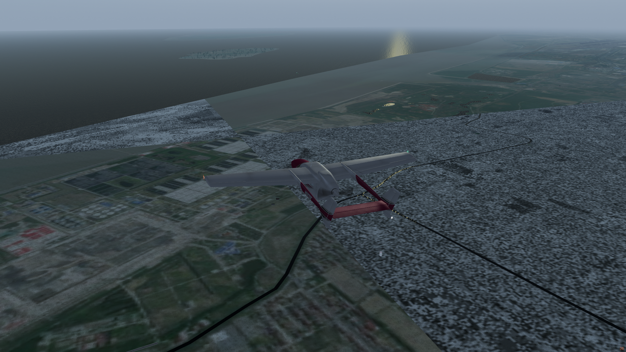
Hi, thanks for the amazing work to enable photo images. I am wondering what image format does the program accept. The following compares png8 with png24. Those downloaded as png8 has a strange mist on them, while the png24 ones are okay to use. Also, the transparent parameter on ArcGIS online has no effect on the rendering. So, what is the best source image to use for photoscenery?
Image

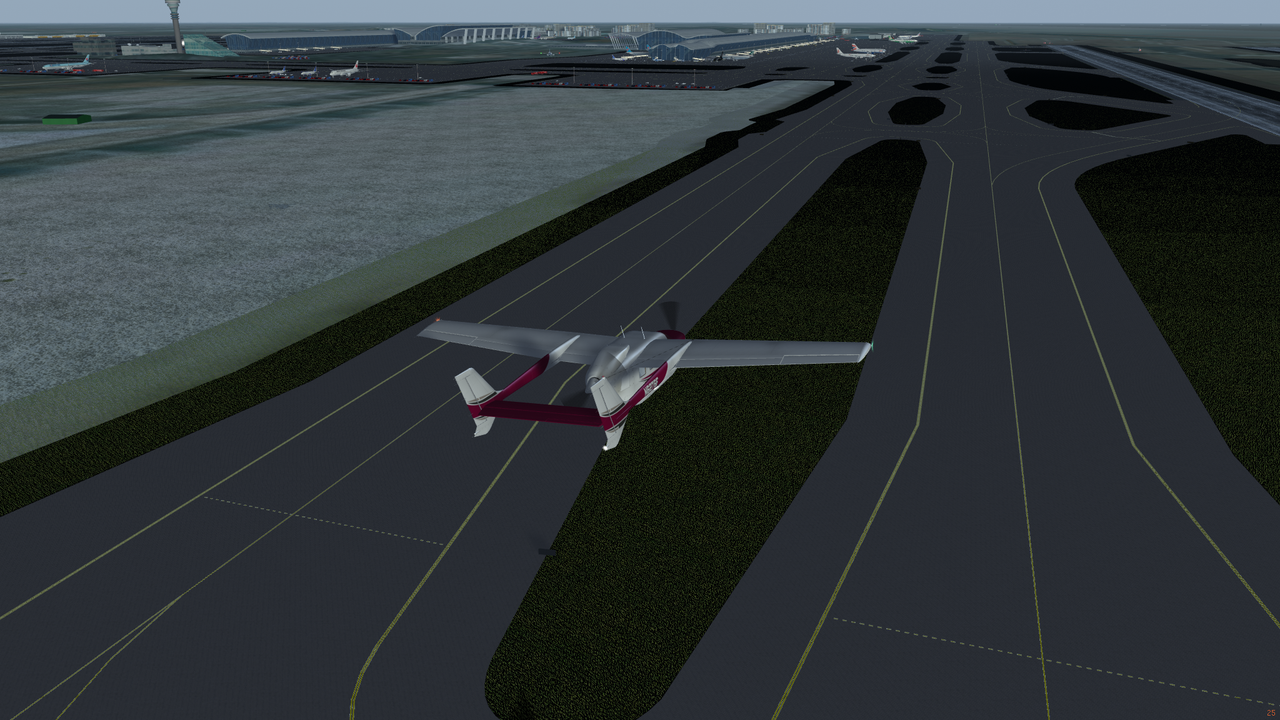
Another question is why volumic grass looks weird when enabled. The ground only looks nice at a certain angle.
Image
awen
 
Posts: 93
Joined: Mon Oct 19, 2020 1:39 am
Location: China
Version: 2020.4.0
OS: Windows 11

Re: Photoscenery?

Postby Timi » Wed Dec 02, 2020 1:51 am

Works nicely with Z17 level Bing Maps.
Image
Timi
 
Posts: 68
Joined: Mon Nov 21, 2016 9:08 am
Callsign: Jaeger
Version: 2020.4.0

Re: Photoscenery?

Postby Timi » Wed Dec 02, 2020 9:31 am

Here's a video of that same flight I posted the picture from.
Timi
 
Posts: 68
Joined: Mon Nov 21, 2016 9:08 am
Callsign: Jaeger
Version: 2020.4.0

Re: Photoscenery?

Postby StuartC » Wed Dec 02, 2020 1:01 pm

Question.

Why png files. There huge. Why not DDS or another more efficient format ?
StuartC
 
Posts: 3179
Joined: Fri Jun 18, 2010 9:18 pm
Location: Arse end of the Universe
Callsign: WF01
Version: 2019.1
OS: W10 64 bit

Re: Photoscenery?

Postby xcvb » Wed Dec 02, 2020 1:22 pm

You should never use jpg for textures if you want to use shaders (they amplify the block artifacts). In the end it is only a question of disk usage and start times (in case mipmaps have to be created during loading). The image format has no influence on the framerate, because the image in GPU memory is always uncompressed.
xcvb
 
Posts: 132
Joined: Sat Mar 14, 2015 3:08 pm
Version: Next
OS: Fedora Kinoite

Re: Photoscenery?

Postby Hooray » Wed Dec 02, 2020 2:03 pm

.
wlbragg wrote in Mon Nov 30, 2020 6:48 pm:Yeah Stuart, look back at some of these posts. It has instructions on how to get 8k or16k. Same source, you just pull them in smaller pieces and then put them together.


To be honest, the thread is getting fairly huge, we should consider updating the wiki so that people can more easily find updated instructions. In the meantime, splitting the topic might make sense - because it was originally not about the current set of patches.
Please don't send support requests by PM, instead post your questions on the forum so that all users can contribute and benefit
Thanks & all the best,
Hooray
Help write next month's newsletter !
pui2canvas | MapStructure | Canvas Development | Programming resources
Hooray
 
Posts: 12707
Joined: Tue Mar 25, 2008 9:40 am
Pronouns: THOU

Re: Photoscenery?

Postby wlbragg » Wed Dec 02, 2020 3:18 pm

@nathaniel515

Feature request...

How hard would it be to have a switch, either in the GUI (may be frowned upon by core devs), or just a flag set in defaults.xml to choose between 4k, 8k or 16k textures? Then in the code maybe just a different folder structure in ortho to support the choice.
i.e.,
ortho/4k
ortho/8k
ortho/16k

I find myself wanting to switch between resolutions in different areas and for developing. It adds a layer of flexibility. I can see arguments for and against it, but as simple as it would be to add, it would be a nice addition IMHO. You could potentially then add material. xml tag pairs based on boundaries to switch resolutions on the fly in areas that don't require a higher resolution.
Kansas and Ohio/Midwest scenery development.
KEQA, 3AU, KRCP Airport Layout
Intel i7/GeForce RTX 2070/Max-Q
User avatar
wlbragg
 
Posts: 7609
Joined: Sun Aug 26, 2012 12:31 am
Location: Kansas (Tornado Alley), USA
Callsign: WC2020
Version: next
OS: Win10/Linux/RTX 2070

Re: Photoscenery?

Postby StuartC » Wed Dec 02, 2020 3:21 pm

@wlbragg
That could also tie in with the lod range settings
StuartC
 
Posts: 3179
Joined: Fri Jun 18, 2010 9:18 pm
Location: Arse end of the Universe
Callsign: WF01
Version: 2019.1
OS: W10 64 bit

PreviousNext

Return to Scenery

Who is online

Users browsing this forum: No registered users and 8 guests