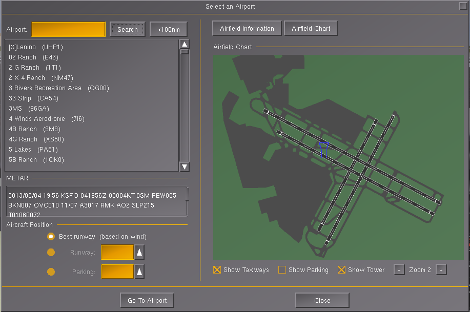
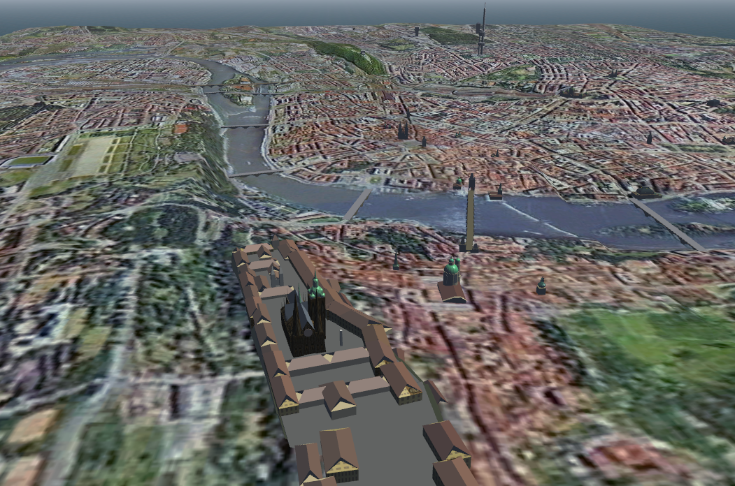
Thorsten wrote in Wed Jun 01, 2016 6:37 am:It is a texture lookup, yes. The encoding to be used is what I'm trying to research at the moment. I'm aiming for some experience with the rendering part so that I know what's needed, useful and not relevant before stating potential requirements for the scenery creation.
So the shader branches between applicable land-class types based on a texture lookup? If there's more than 2 applicable land-class types in a given area with procedural aspects, will all branches be evaluated because of SIMD GPU processing or is there a way around it?.. Transition regions sort of conceptually imply 1-2x more load..
The screens look great. Meta-information maybe(?) could be used to classify areas in textures, like with the screens posted, classifying buildings/trees/roads/floodable areas/water to stop specific types of colour influence from transitions/underlying terrain..8(=n+m) bits of a texture channel can store n flags+region id out of m^2 possibilities.. That would allow texture areas showing grass/crops to be influenced, but not others. Areas could be reinterpreted via regional definitions for different landclasses, or environment settings.
Thorsten wrote in Wed Jun 01, 2016 6:37 am:We may want to add complexity to the raster image though - specify what pattern to use for the transition for instance, store information about roughness and height-mapping,...
Additional data needed to describe a transition at different scales would seem to depend on the type of landclasses on either side of the boundary, maybe..so perhaps interpreting datafields differently would save space.
e.g. a crisp boundary between managed forest or other human influenced terrain might be best described with a description of a curve to be somehow calculated taking data on 2+ neighboring squares (on a scale >5m). Other transitions might involve islands/coverage, distance fields, boundary characteristics at different scales..
The interesting regions are the boundaries/transition areas..if the ability to compress identical areas of something like png for hdd storage is not good enough, a multi-resolution data-structure may work (assuming the idea is to avoid vector representation in downloaded terrain data too).
Regards,
vnts