Board index ‹ FlightGear ‹ Support
Airport diagram on nav display?
Forum rules
In order to help you, we need to know a lot of information. Make sure to include answers to at least the following questions in your initial post.
- what OS (Windows Xp/Vista, Mac etc.) are you running?
- what FlightGear version do you use?
- what graphics card do you have?
- does the problem occur with any aircraft, at any airport?
- where did you download your aircraft/scenery from?
- is there any output printed to the console (black window)?
- copy&paste your commandline (tick the "Show commandline box on the last page of FGRun or the "Others" section on the Mac launcher).
Please report any bugs not specific to an aircraft on the issue tracker.
To run FlightGear on old computers with bad OpenGL support, please take a look at this wiki article.
Note: If you did not get a reponse, even after 7 days, you may want to check out the FlightGear mailing lists to ask your question there.
4 posts
• Page 1 of 1
Airport diagram on nav display?
![]() by turkish_aviator » Thu Feb 11, 2021 9:47 pm
by turkish_aviator » Thu Feb 11, 2021 9:47 pm
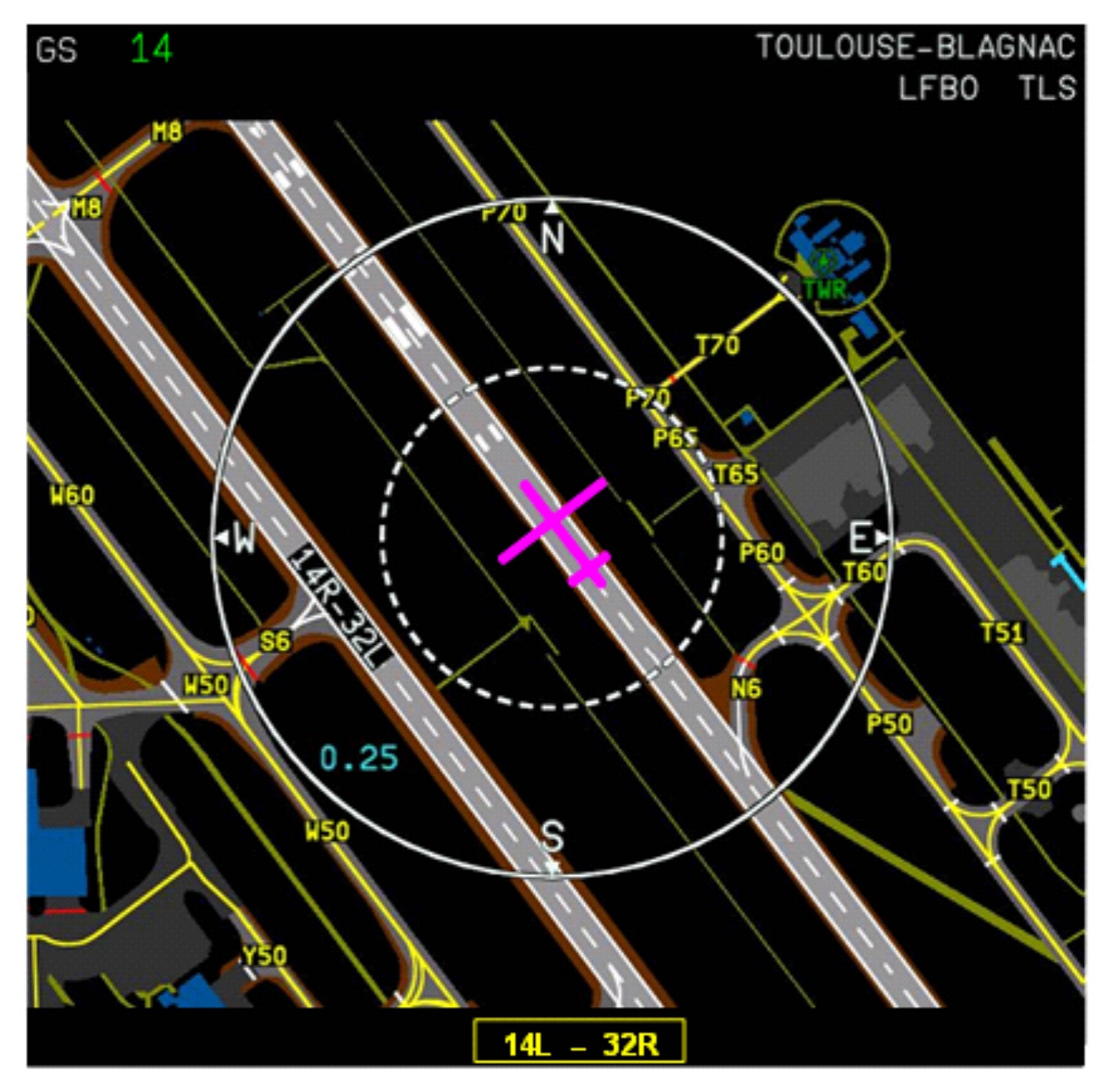
In some videos on YouTube, i saw when the pilots press the "airport(arpt or something like that)" button o the mcp, the airport diagram was appearing on the nav display, is there a way to use that feature in fgfs? 
- turkish_aviator
- Posts: 69
- Joined: Thu Oct 08, 2020 9:37 pm
- Version: Latest
- OS: Win7
Re: Airport diagram on nav display?
![]() by Hooray » Thu Feb 11, 2021 10:36 pm
by Hooray » Thu Feb 11, 2021 10:36 pm
It's a conventional Canvas display, I believe driven by the MapStructure framework: https://wiki.flightgear.org/Canvas_MapStructure
https://wiki.flightgear.org/Canvas_MapStructure_Layers
If in doubt, refer to airports.xml in $FG_ROOT/gui/dialogs
The Qt stuff (launcher) won't work for in-sim avionics for the time being. as that would make Qt a mandatory dependency, which some core devs were once opposed to.
https://wiki.flightgear.org/Canvas_MapStructure_Layers
If in doubt, refer to airports.xml in $FG_ROOT/gui/dialogs
The Qt stuff (launcher) won't work for in-sim avionics for the time being. as that would make Qt a mandatory dependency, which some core devs were once opposed to.
Please don't send support requests by PM, instead post your questions on the forum so that all users can contribute and benefit
Thanks & all the best,
Hooray
Help write next month's newsletter !
pui2canvas | MapStructure | Canvas Development | Programming resources
Thanks & all the best,
Hooray
Help write next month's newsletter !
pui2canvas | MapStructure | Canvas Development | Programming resources
- Hooray
- Posts: 12707
- Joined: Tue Mar 25, 2008 9:40 am
- Pronouns: THOU
Re: Airport diagram on nav display?
![]() by erik » Fri Feb 12, 2021 9:09 am
by erik » Fri Feb 12, 2021 9:09 am
It's the On-Board Airport Navigation System (OANS):
https://www.airbus.com/newsroom/news/en ... craft.html
I don't know it any of the aircraft has it implemented at the moment.
Erik
https://www.airbus.com/newsroom/news/en ... craft.html
I don't know it any of the aircraft has it implemented at the moment.
Erik
Current: Parachutist, Paraglider, Pterosaur, Pilatus PC-9M and variants, ERCO Ercoupe, Fokker Dr.1, Fokker 50, Fokker 100
Less active: Cessna T-37, T-38, Santa Claus. Previous: General Dynamics F-16. Worked on: Wright Flyer
Less active: Cessna T-37, T-38, Santa Claus. Previous: General Dynamics F-16. Worked on: Wright Flyer
- erik
- Posts: 2248
- Joined: Thu Nov 01, 2007 2:41 pm
Re: Airport diagram on nav display?
![]() by Hooray » Fri Feb 12, 2021 10:11 am
by Hooray » Fri Feb 12, 2021 10:11 am
Sorry, I misunderstood the question - Erik is right, we've previously talked about implementing that.
In other words, my response still is correct: you'd want to take a look at airports.xml (which is where we have an airports/runway diagram) and port that into a MapStructure layer, that should typically take 1 hour at most (since the underlying code is already using Nasal and Canvas). At that point, all you need is adding 3 lines of code to the ND to display the airport/runway diagram there.
With that being said, that's only relevant if people haven't already come up with such a layer, like Erik said.
Just to be clear about it, open the airports.xml dialog (in-sim) to see for yourself that we already have the required functionality (styling, colors, appearance) can be easily customized as needed.
Making THAT display show up in-sim on an ND really is very straightforward to do.
If in doubt, check whether the FG1000 already has support for this, because Stuart implemented both features originally, so if it's been done already, he would be aware of it (or send him a message or post to the devel mailing list before starting any work).
How to display Airport Chart?
Please don't send support requests by PM, instead post your questions on the forum so that all users can contribute and benefit
Thanks & all the best,
Hooray
Help write next month's newsletter !
pui2canvas | MapStructure | Canvas Development | Programming resources
Thanks & all the best,
Hooray
Help write next month's newsletter !
pui2canvas | MapStructure | Canvas Development | Programming resources
- Hooray
- Posts: 12707
- Joined: Tue Mar 25, 2008 9:40 am
- Pronouns: THOU
4 posts
• Page 1 of 1
Who is online
Users browsing this forum: No registered users and 7 guests